
Overview
Starting point: Alpnachstad Station (450m)
Summit: Pilatus Kulm (2070m) + Esel (2118m)
Highest point: Esel
Distance: 1,680m of elevation gain incuding Esel
Duration: around 4-5 hours up
Optional shortcut: Take the funicular to Ämsigen mid-station (1350m) to cut the hike in half
Descent: Funicular down (or same way on foot for an even bigger adventure!)
I started from Alpnachstad Station at 450m, right at the base of the Pilatusbahn funicular. Parking can fill up quickly, so it’s best to arrive early or avoid weekends if you can.
From the base, you backtrack slightly through town to find a sign pointing uphill to Pilatus Kulm. Within minutes, you rise above the houses and get sweeping views of the lake below. The first stretch follows the funicular tracks across green pastures—an idyllic start!
Eventually, you pass underneath the funicular and enter the forest. A short road section follows, until a path veers left, marked as a 4-hour hike to the summit.
From there, it’s a long, mostly straight climb through dense forest. The trail isn’t too steep, but it’s relentless—no real flat sections to catch your breath.
After about an hour, the zigzags begin in earnest. The first half-hour is shaded and goes smoothly. Then you reach a clearing where the funicular is visible again, and the zigzags continue. A sign soon appears, announcing you’re nearing Ämsigen mid-station at 1,350m. After another 20 minutes of sun-exposed zigzags, you finally arrive there.
If you’d like a shorter hike, you can take the funicular to Ämsigen—it cuts the climb roughly in half. It took me about 2 hours to reach this point, and I was definitely feeling it!
Shortly after Ämsigen, there’s a sign giving you two options: the direct route to Pilatus, or a longer variant via Matthorn. I opted for the direct route, which starts alongside the funicular tracks at a steady pace. I was getting tired and took a break for a picnic to recharge.
After the break, I pushed on. At the end of a green valley, the path and the funicular tracks split. You can see the train crawling up the rock face of Esel, the final high point of the hike. But the trail heads left onto a shoulder of the mountain—where the zigzags resume, tougher than before!
After about 20 solid minutes of switchbacks, you crest the top. A short downhill stretch and a bit of flat ground give you a breather. A sign says 40 minutes to the summit, and you can see your goal nested in the mountains above you.
For the final half-hour, you zigzag again up a rocky slope—Pilatus looming above and tourists cheering you on from the summit platform. Finally, you arrive at Pilatus Kulm (2070m)!
At the top, it’s a typical Swiss mountain scene: luxury watch shops, hotel cafés, and a lively crowd. I celebrated with a cappuccino and a bottle of Fanta—desperately needed after the sun-soaked climb! Then I headed up to the start of the short trail to Esel (2118m), which was officially closed with fences. But everyone was ignoring them, so I followed suit—after all, I’d come this far!
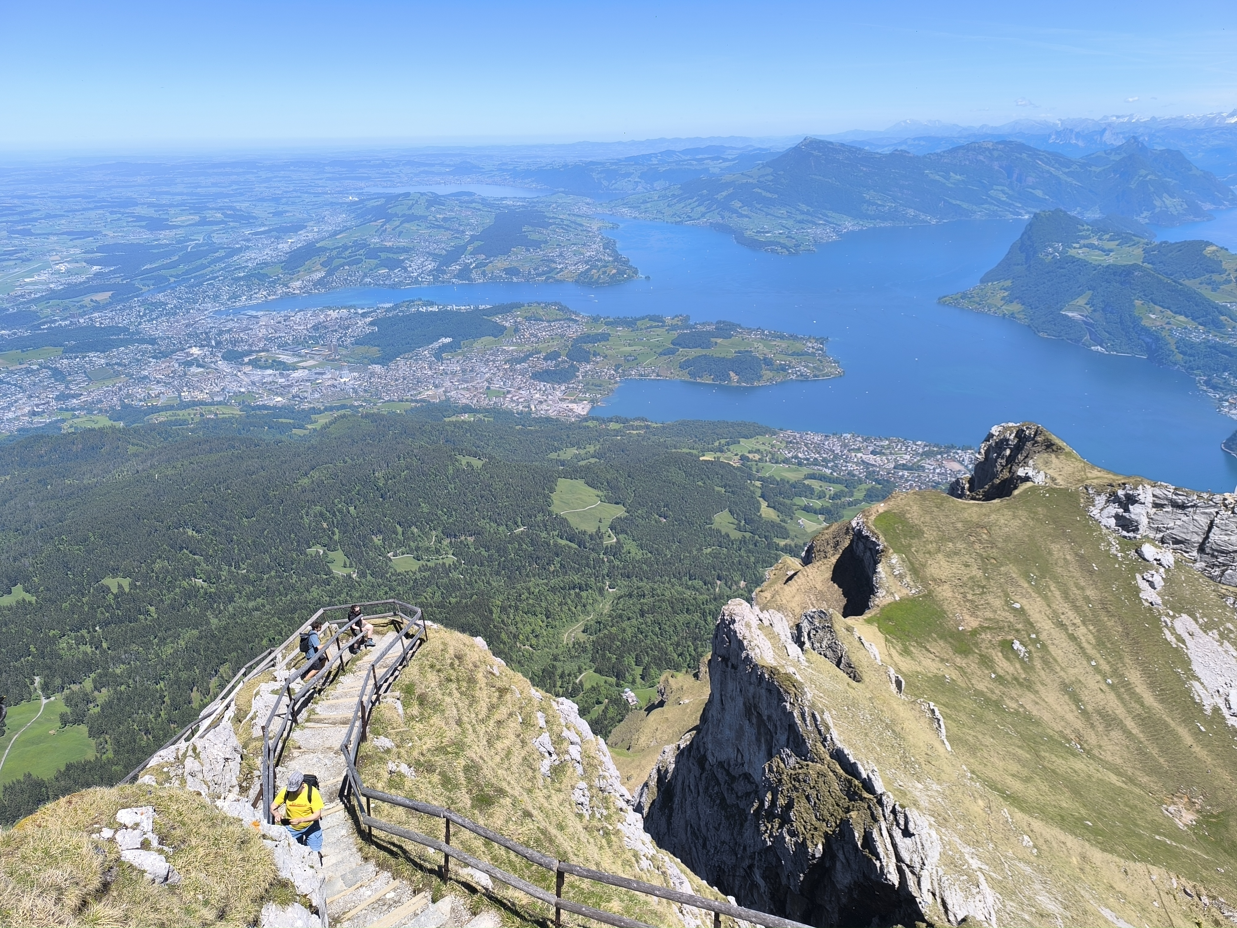
Less than 10 minutes later, I reached the Esel summit and its broad viewing platform. The panorama is spectacular: Lake Lucerne (the Vierwaldstättersee), stretching as far as Sursee and Zugersee. So many lakes! On the other side, sheer cliffs drop dramatically beside Pilatus.After a final look around, I headed back down to the summit area to buy my funicular ticket. Even on a Friday, it was busy, but I managed to get a spot without waiting long. In 35 minutes, the funicular carried me down—truly the magic of the Swiss mountains!


Comments
Post a Comment