Campanile di Val Montanaia

Overview
-
Start point: Rifugio Padova (1310 m), near Domegge di Cadore
-
Highest point: Forcella Montanaia (2333 m)
-
Duration: ~6 hours round trip
-
Difficulty: Medium to hard (short climbing sections and steep scree descent)
-
Highlights:
-
Stunning views of jagged Dolomite peaks
-
The iconic Campanile di Val Montanaia
-
A fun scree descent (ghiaione)
-
Rich variety of alpine landscapes

This hike starts at Rifugio Padova (1310 m), near Domegge di Cadore. Reaching the hut requires driving up a narrow mountain road that only allows uphill traffic in the morning and downhill in the afternoon—so be sure to check the schedule before heading up. The hut also features nice wooden sculptures.


From the hut, you're immediately rewarded with a breathtaking view: a dramatic amphitheater of jagged Dolomite peaks. The goal of the hike is to reach the valley beyond those peaks, home to the striking Campanile di Val Montanaia, a needle-like rock tower standing alone in a wide alpine basin.


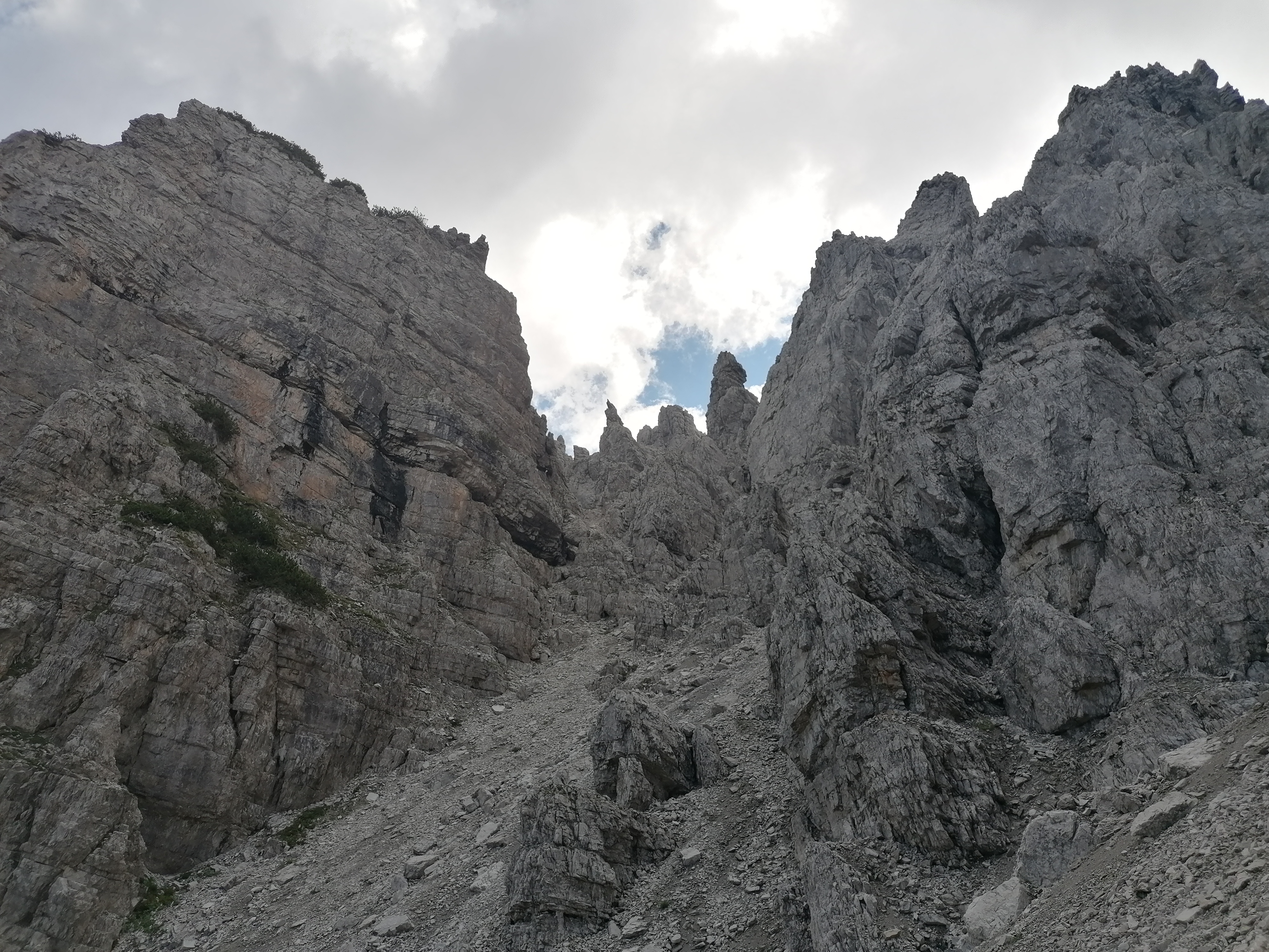
I did this hike with my dad, and we started from the hut, following the trail that climbs steadily through a low alpine pine forest toward Forcella Giumelli (2260 m). Around 1700 m, the vegetation thins out and gives way to a rocky landscape. Shortly after, the trail enters a gully—the most challenging section of the hike. It includes short climbing passages and occasional ropes for support. It’s steep and demanding, but manageable with some caution.


The trail leads to a spot slightly above the Campanile, where there’s a small bivouac hut and a grassy lawn—perfect for a lunch break with a view. At this point, you’re at about 2050 m.
After the break, the path continues climbing gently up the valley. The grass slowly disappears, replaced by loose rock as you approach Forcella Montanaia (2333 m). Don’t forget to turn around and take in the view: the Campanile becomes ever more isolated against the backdrop of the widening valley.


It’s essential to do the loop counterclockwise, as climbing up the ghiaione would be exhausting and frustrating.
Eventually, the scree gives way to firmer ground, and about 15 minutes later, vegetation returns. From here, a final one-hour descent through forested terrain leads gently down the valley and back to Rifugio Padova, completing the loop.


Comments
Post a Comment