Tour of Sassolungo

Overview
- 🏔 Route: Circular loop around the Sassolungo group
- 📍 Start & End: Rifugio Carlo Valentini, near Passo Sella (2218m)
- 🥾 Distance: ~16 km
- ⛰ Elevation gain/loss: 680 m
- 🕒 Duration: ~6 hours including breaks
- 🚶♂️ Difficulty: Moderate – long but without technical challenges

This hike is a long and panoramic loop without particular technical difficulties. It’s not a stroll, though – the distance and elevation make it a solid day hike. But it’s absolutely worth it for the ever-changing landscapes and continuous views of the iconic Sassolungo group.
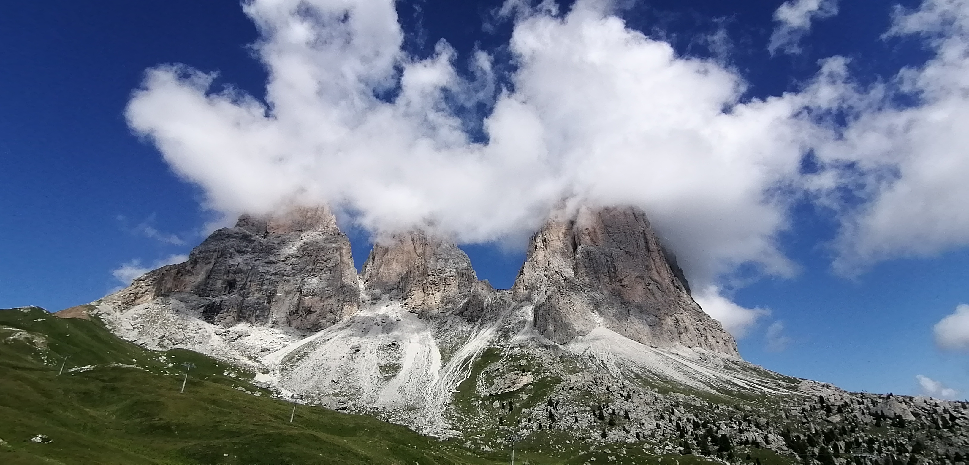
The hike can start from several places, but the most typical and accessible trailhead is the large parking at Rifugio Carlo Valentini near Passo Sella (2218m), located at the linguistic border of South Tyrol’s German-speaking area. The trail starts just before the pass, and right from the beginning, you’re treated to sweeping views of the Sassolungo ridge – perhaps the most beautiful perspective of the entire loop.
We hiked clockwise, and here’s how it unfolded:
🟢 Stretch 1: Passo Sella to Rifugio Pertini (~1h15)


🟡 Stretch 2: Rifugio Pertini to Giogo di Fassa (~50 min)
Similar in landscape and difficulty to the first part, this stretch includes another 120 meters of ups and downs. Along the way, you’ll pass some huts and possibly see horses grazing. At Giogo di Fassa, several trail options open up: you can ascend to Sassolungo’s summit, descend to Val Duron, or continue the loop – which we did.

🔵 Stretch 3: Giogo di Fassa to the valley floor (~1h30)
This is where the terrain changes. Meadows give way to rockier landscapes, and you descend significantly – around 350 meters. After hours of hiking, I found myself thinking, “Gosh, I’ll have to climb this back up later.” I’m more used to getting the uphill done first!
The steeper descent eventually leads into a gentler valley wrapping around Sassolungo. At the bottom, you reach the lowest point of the hike and a fork with two return options.
⚖️ Route Choice
From this junction, you can either:
- Climb to Rifugio Toni Demetz (2681m) through a steep 700m ascent, then descend via a small cable car directly to Passo Sella.
- Complete the loop, which we chose – longer but much less steep.

🔴 Stretch 4: Valley floor to Rifugio Comici (~1h20)

Side note: the toilets at Rifugio Comici are unlike any you’d expect on a hike – they look like they belong in a chic nightclub, which made for a surreal contrast with the natural surroundings.


🟣 Stretch 5: Rifugio Comici to Passo Sella (~1h)
The final stretch follows a grassy ridge along Sassolungo and climbs about 130 meters. It’s a beautiful conclusion to the hike, with a spectacular view of the Sella Group directly in front as you return to the pass.
Final Thoughts
The full loop covers 16 km, with 680 meters of elevation gain (and loss), and takes around 6 hours including breaks. It’s a long but thoroughly enjoyable hike, offering continuous Dolomite views, a variety of terrains, and several charming mountain huts to stop at. If you’re in the area and up for a full day outdoors, this is a hike not to miss.


Comments
Post a Comment