Col du Soladier – A Quiet Spring Tradition

Overview
-
Start point: Cergniaule (1300m), above Les Avants
-
Best season: Winter with snowshoes or late spring
-
Estimated duration: ~2h solo, ~3h in snow or with kids
Elevation : about 350m
-
Highest point: ~1630m unnamed pass
This is, for some reason, one of my spring rituals. I hike it every year around March or April, even though I always end up recommending it more as a snowshoe trail in full winter. Still, there's something about that in-between season that draws me here—when the snow is receding, but not quite gone.
Starting the Hike
The trail starts in Cergniaule (1300m), just above Les Avants and a bit past the Sonloup funicular’s top station, which also marks the highest point of the famous Narcisses hike. There's a small parking area and a public refuge that's always open. In spring, you’ll usually find a tiny café open too—great for a quick coffee before heading off.
The road splits almost immediately. While the Col du Soladier is marked to the left, I always take the right fork, doing the loop counterclockwise. Call it tradition or habit.
To Cabane La Planiaz
After a few bends, the trail wraps around the hill and opens up to fantastic views of Dent de Jaman and Rocher de Naye—but those are stories for another post. The road continues gently until Cabane La Planiaz, a peaceful spot where I usually stop for a quiet picnic. The cabin is always closed when I visit, but it has benches outside and a pleasant atmosphere.


Forest Shortcut to the Pass

After around 20 minutes, look for a small, easy-to-miss sign pointing left off the road. This is the official snowshoe trail. You could keep following the road for a longer loop, but I usually take this shortcut through the forest.


The Silent Valley
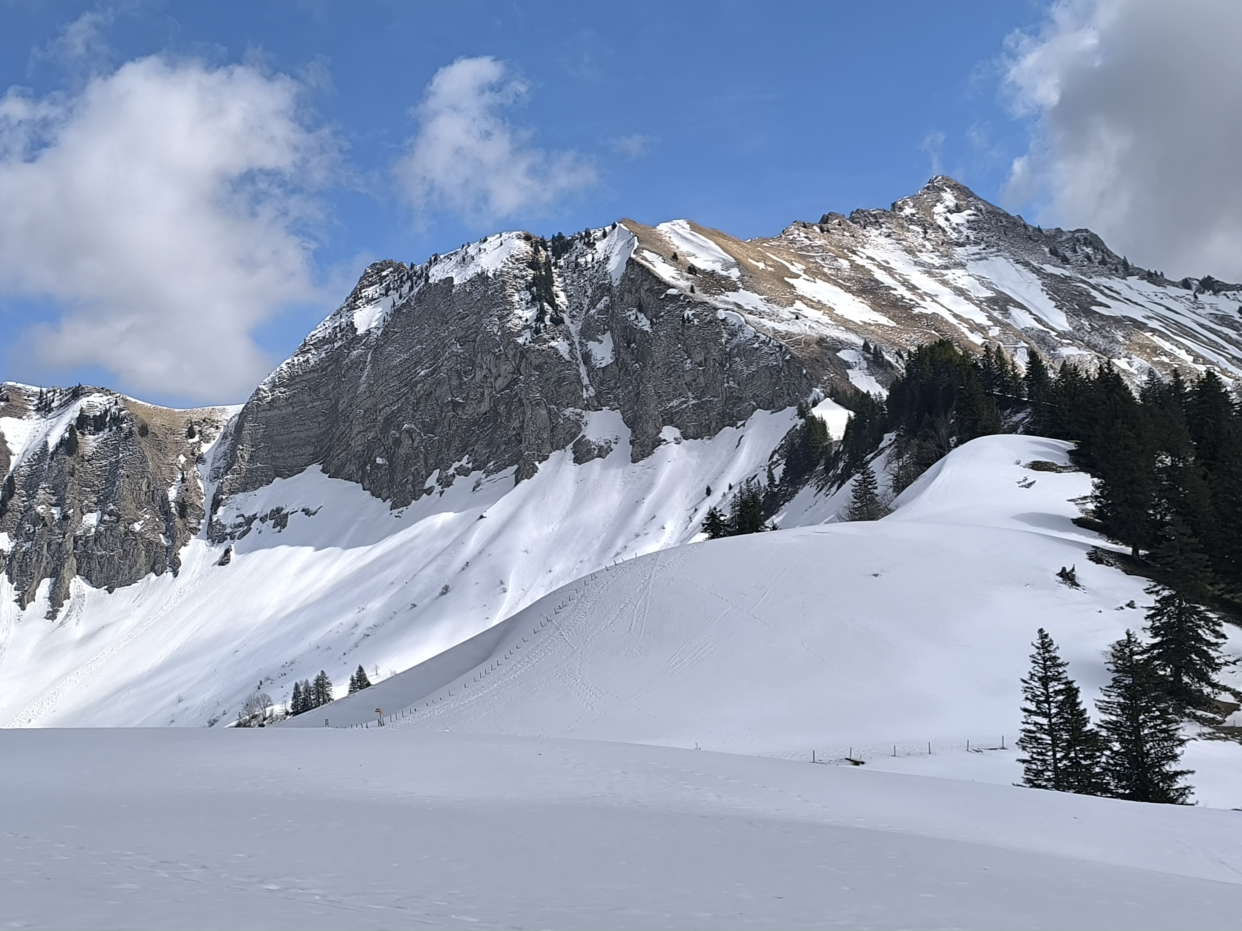
After rounding the hill, you’ll descend into a small, silent valley with an alpage. This is one of my favorite spots on the trail. In winter, it’s incredibly quiet—so much so that your ears buzz from the absence of sound. I often sit here in contemplation for a few minutes. It’s a rare kind of stillness.
 Return via Cabane des Bûcherons

The trail then widens and gently descends. After about 10 minutes, you’ll reach Cabane des Bûcherons, another perfect picnic stop with a big tree-trunk bench and a panoramic viewpoint.


-
If you're the kind of hiker who needs to conquer a summit, take a 20-minute detour to the Molard (1752m).
-
Otherwise, continue down the wide gravel road that loops back to the trail split near the start.
I usually complete the whole loop in under 2 hours when I’m alone. In winter, or with kids, it’s more like 3 hours—but every minute of it is worth it.


Comments
Post a Comment