The forgotten ones (Zentral Schweiz)
Here a new forgotten hikes post! This time in central Switzerland.
Rigi (Schwyz)
- Start point: Alpenhof parking near Küssnacht, 550m
- Destination: Loop to the start
- Highest point: Rigi Kulm, 1797m
- Distance: ~15 km loop
- Elevation gain: ~1200 m
- Time: ~6-7h
- Difficulty: Moderate to challenging
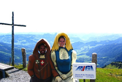
Rigi (1797m) is a very famous summit in Central Switzerland. Super easy to each because you can also get there by train from Viznau (but we are stubborn and we did it on foot). It was a long time ago and I remember little about the hike but you find the path in the age and link. There are several ways you can take we decided for a circular one. The highlights were of course the ridge at the summit but even more a viewpoint names Chänzeli on the way back overlooking the 4 canton lake!
Rütli (Uri)
- Start point: Rütli dock, 450m
- Destination: Bauen, 450m
- Highest point: Seelisberg, 860m
- Distance: ~7.5 km
- Elevation gain: ~475 m up and down
- Time: ~2.5h
- Difficulty: Easy
This hike merits the label "historical" even if it does now really have any historic remains. This is because it goes through Rütli. The lawn where the legend says Switzerland was founded. From there a long (modern) trail starts with sections dedicated to each canton long proportionally to their population.
We started the hike taking the boat in Bauen (450m) that bring you in a few minutes to the dock at Rütli. There the first part is the steepest. Going up the hill to Seelisberg (860m), the highest point of this hike. From there is continues up and down over the hills in direction of Bauen across green laws and pastures. Always on the road or countryside gravel roads or well marked paths. And of course you'll get amazing views of the lakes below at several places. We stopped in Bauen where we had left the car. This section takes 7.5km and about 2.5h to complete. But the trail continues all the way to Brunnen for at least 20-30 more kilometers!
Trübsee (Obwalden)
- Start point: Trübsee midstation, 1800m
- Destination: Should have been Jochpass, 2207m
- Highest point: Same as destnation
- Distance: ~7.5 km including lake tour or 3km lake tour only
- Elevation gain: ~450 m if you go all the way to Jochpass
- Time: ~2.5-3h to Jochpass, 1h lake tour only
- Difficulty: Moderate to Jochpass, Easy lake tour only
This is a path that I actually remember quite well but we did not finish to I relegate it to the forgotten paths. It was no less beautiful though! Starting from Engelberg (1000m) you can take the cable car to Trübsee mid station (1800m). The cable car continues after to Titlis at 3062m where you'll be on the glacier. But for this time we stopped in Trübsee and started hiking downhill to the lake (about 1770m). A very nice short walk is just the tour of the lake, that is very beautiful and has plenty of relax, picnic and playground points. The tour is about 3km and would take 40-50min. What we tried to do is reach Jochpass (2207m). To do so you have to go straight along the side of the lake instead of doing the tous and at the corner opposite to the cable car station the path starts to climb quite steep to the pass. It takes about 450m of elevation and 1h to reach the pass, normally without particular difficulties. However we went in may and midway to the pass, around 2000m there was still snow. We tried to takle it a bit but it became too deep and we were not equipped so we decided to go down and do the before mentioned tour of the lake instead!


Comments
Post a Comment