Le Suchet

As is typical for Jura hikes, you can approach it from various sides, and even more so for Le Suchet—even from France!
Here’s a quick inventory of the main routes:
-
From Grange Neuve: 40 minutes to the summit, a 2-hour loop with 370m elevation gain in total if returning along the ridge (see detailed description below).
-
From Baulmes: 12.6 km round trip with 910m elevation gain. A challenging route.
-
From Refuge du Chaudron: 7.2 km and 860m elevation gain. Steep, especially at the beginning.
-
From Mathulaz: 4.2 km and 440m elevation gain. It’s a midpoint of the previous option and reachable by car.
-
From Entre Les Fourgs (Jougne, FR): 16 km and 700m elevation gain. Quite a long route!
In this post, I’ll dive into the first one—from Grange Neuve—because it’s the perfect, easy family hike.

Grange Neuve is a restaurant at 1340m in the valley between Le Suchet and the Aiguilles de Baulmes. You can get there via a narrow road starting behind the village of Baulmes. There’s also parking at the restaurant.


From the end of the parking lot, a gravel road begins. Be careful—after about 5 minutes, you need to take the path on the right, off the main road. The signposting here is not super clear. After a while, the pastures become forest, and the path eventually reaches the ridge and curves back to the summit. The total climb is 270m, with the summit sitting at 1588m.


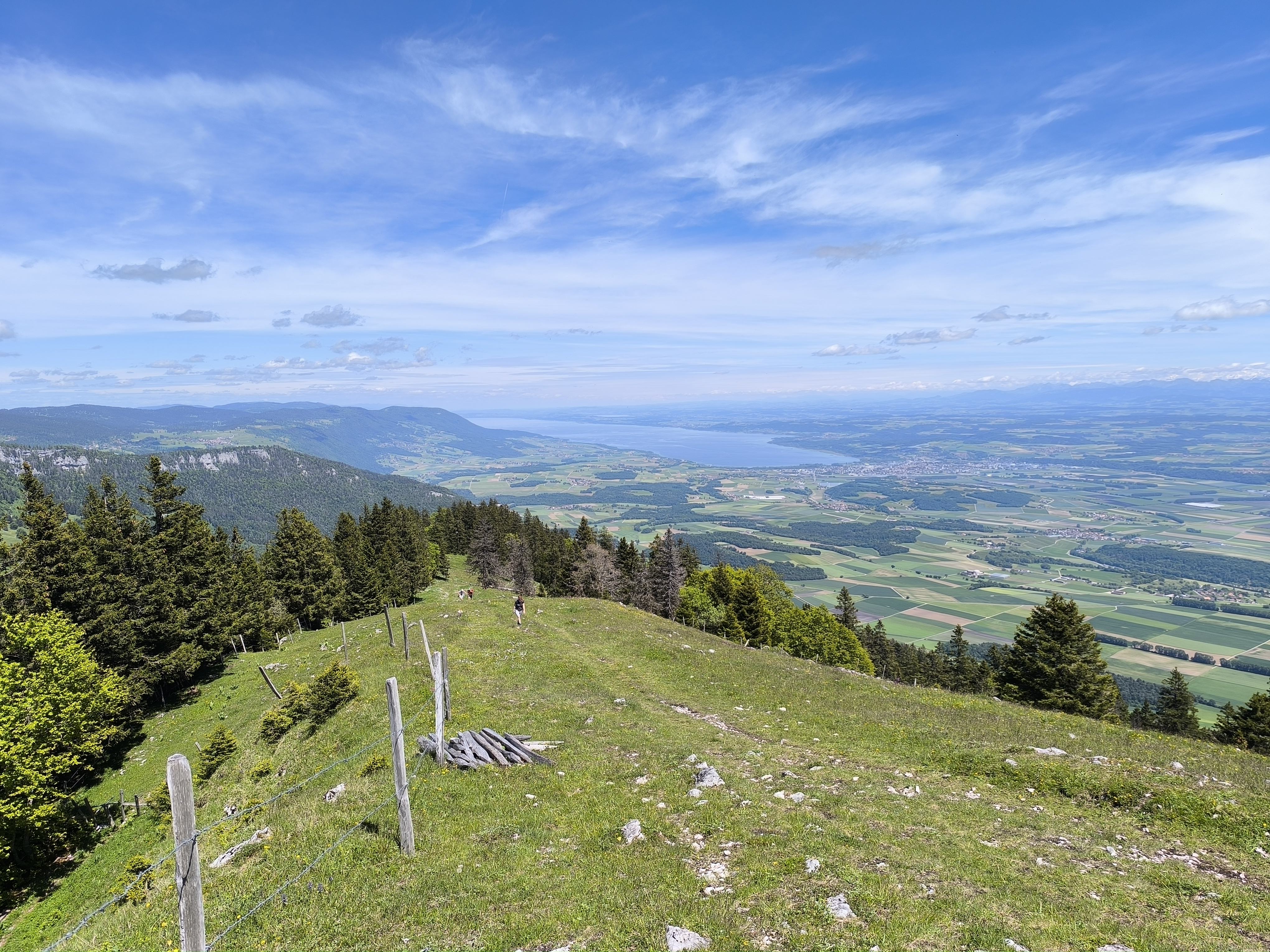
The way back is the real highlight! You descend along a wide ridge with Lake Neuchâtel spread out before you.


Comments
Post a Comment